Uploads by Cedh
Jump to navigation
Jump to search
This special page shows all uploaded files.
| Date | Name | Thumbnail | Size | Description | Versions |
|---|---|---|---|---|---|
| 23:39, 2 September 2018 | Antarctica-VerticalPerspective.png (file) | 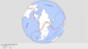 |
360 KB | 1 | |
| 23:39, 2 September 2018 | Antarctica-Orthographic.png (file) | 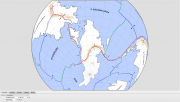 |
476 KB | 1 | |
| 23:39, 2 September 2018 | Antarctica-HammerAzimuthal.png (file) | 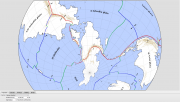 |
539 KB | 1 | |
| 23:38, 2 September 2018 | Antarctica-EquirectangularRegional.png (file) | 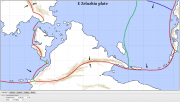 |
166 KB | 1 | |
| 05:53, 22 January 2017 | Lu-giəma.png (file) | 14 KB | The native name of the Fáralo alphabet, ''lu-giəma æm Fáralo'', written in the script itself. | 1 | |
| 05:07, 22 January 2017 | Fáralo alphabet.jpg (file) | 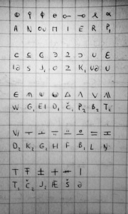 |
183 KB | b/w & better contrast | 2 |
| 11:03, 30 November 2016 | Naidda dialects.png (file) | 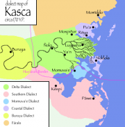 |
34 KB | 2 | |
| 10:28, 30 November 2016 | SE Tuysafa languages 0YP.png (file) | 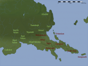 |
122 KB | A linguistic map of southeastern Tuysáfa around 0 YP, showing the distribution of Dumic languages (in red) and T1 languages (in green). Base map by Thedukeofnuke, data by Cedh. ©2012-2015. Category:Maps Category:Language families | 1 |
| 10:24, 30 November 2016 | Peilash physical map general unlabeled.png (file) |  |
2.54 MB | A blank physical map of Northern Peilaš. {{commentbox|©2010 by a pocketful of songs.}} Category:Maps Category:Geography | 1 |
| 10:00, 29 November 2016 | Peilaš linguistic 0YP.jpg (file) |  |
293 KB | A linguistic map of Peilaš around 0 YP, showing the approximate distribution of the major language families. Base map by pocketful of songs, language data by CatDoom. From west to east: * Gray-blue: Lukpanic languages * Purple: [[Western language... | 1 |
| 14:17, 7 May 2013 | Yuska.png (file) |  |
114 KB | (transparent background) | 2 |
| 15:01, 11 May 2011 | Ndak-empire--1800.png (file) | 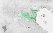 |
506 KB | 2 | |
| 14:37, 9 May 2011 | Languages-1st-generation-daiadak-1200.png (file) | 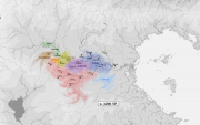 |
393 KB | A linguistic map showing the first generation of Dāiadak languages around 1200 YP (i.e. those languages directly descended from Adāta). {{commentbox|©2010 by Cedh.}} | 1 |
| 14:35, 9 May 2011 | Languages-1st-generation-edastean-100.png (file) | 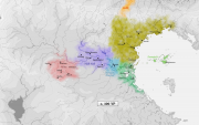 |
436 KB | A linguistic map showing the first generation of Edastean languages around 100 YP (i.e. those languages directly descended from Ndak Ta). {{commentbox|©2010 by Cedh.}} | 1 |
| 14:32, 9 May 2011 | Athale-and-huyfarah-400.png (file) | 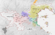 |
484 KB | A map of the Empire of Athalē and Huyfárah around 400 YP, when both empires had more or less reached their maximum extension, with some linguistic info about the major Edastean languages of the time. {{commentbox|©2010 by Cedh.}} | 1 |
| 13:24, 9 May 2011 | NE-Peilash-physical3.png (file) |  |
1.13 MB | A coloured version of this map. Map by pocketful of songs, modifications by Cedh. | 1 |
| 11:15, 3 May 2011 | PW Ex27.png (file) |  |
14 KB | 1 | |
| 11:15, 3 May 2011 | PW Ex26.png (file) | 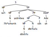 |
14 KB | 1 | |
| 11:14, 3 May 2011 | PW Ex25.png (file) | 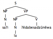 |
9 KB | 1 | |
| 11:13, 3 May 2011 | PW Ex24.png (file) | 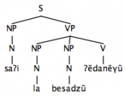 |
9 KB | 1 | |
| 11:13, 3 May 2011 | PW Ex23.png (file) | 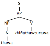 |
7 KB | 1 | |
| 11:13, 3 May 2011 | PW Ex22.png (file) | 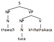 |
9 KB | 1 | |
| 11:13, 3 May 2011 | PW Ex21.png (file) | 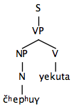 |
7 KB | 1 | |
| 11:12, 3 May 2011 | PW Ex20.png (file) | 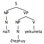 |
8 KB | 1 | |
| 11:12, 3 May 2011 | PW Ex19.png (file) | 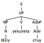 |
9 KB | 1 | |
| 11:12, 3 May 2011 | PW Ex18.png (file) | 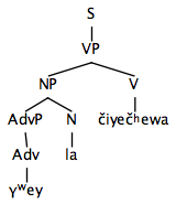 |
9 KB | 1 | |
| 11:12, 3 May 2011 | PW Ex17.png (file) | 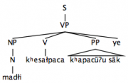 |
10 KB | 1 | |
| 11:11, 3 May 2011 | PW Ex16.png (file) | 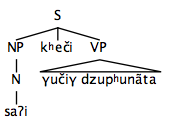 |
9 KB | 1 | |
| 11:11, 3 May 2011 | PW Ex15.png (file) | 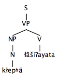 |
7 KB | 1 | |
| 11:11, 3 May 2011 | PW Ex14.png (file) | 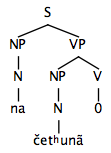 |
8 KB | 1 | |
| 11:11, 3 May 2011 | PW Ex13.png (file) | 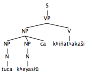 |
10 KB | 1 | |
| 11:10, 3 May 2011 | PW Ex12.png (file) | 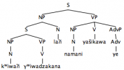 |
13 KB | 1 | |
| 11:10, 3 May 2011 | PW Ex11.png (file) | 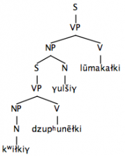 |
11 KB | 1 | |
| 11:09, 3 May 2011 | PW Ex10.png (file) |  |
10 KB | 1 | |
| 11:09, 3 May 2011 | PW Ex9.png (file) |  |
11 KB | 1 | |
| 11:08, 3 May 2011 | PW Ex8.png (file) |  |
10 KB | 1 | |
| 11:08, 3 May 2011 | PW Ex7.png (file) |  |
9 KB | 1 | |
| 11:08, 3 May 2011 | PW Ex6.png (file) |  |
6 KB | 1 | |
| 11:08, 3 May 2011 | PW Ex5.png (file) | 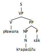 |
8 KB | 1 | |
| 11:07, 3 May 2011 | PW Ex4.png (file) | 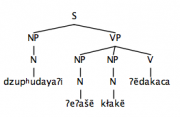 |
9 KB | 1 | |
| 11:07, 3 May 2011 | PW Ex3.png (file) | 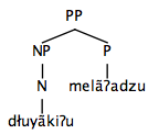 |
7 KB | 1 | |
| 11:07, 3 May 2011 | PW Ex2.png (file) | 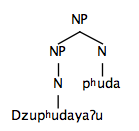 |
7 KB | 1 | |
| 11:06, 3 May 2011 | PW Ex1.png (file) |  |
8 KB | 1 | |
| 04:25, 1 January 2011 | Sc arid-5 .png (file) |  |
112 KB | 1 | |
| 04:25, 1 January 2011 | Sc river-6 .png (file) |  |
88 KB | 1 | |
| 04:24, 1 January 2011 | Sc river-5 .png (file) |  |
131 KB | 1 | |
| 05:00, 16 October 2010 | NE-Peilash-physical2.png (file) |  |
701 KB | A slightly modified version of this map (smaller area, blue ocean, coastline, png format). Map by pocketful of songs, modifications by Cedh. | 1 |
| 12:04, 7 August 2010 | Isthmus history 10 +1200.png (file) |  |
736 KB | A historical map of the Isthmus region, c. 1200 YP. {{commentbox|©2010 by Cedh. <br>This map is part of the series History of the Isthmus region.}} Category:Maps | 1 |
| 12:02, 7 August 2010 | Isthmus history 09 +800.png (file) |  |
745 KB | A historical map of the Isthmus region, c. 800 YP. {{commentbox|©2010 by Cedh. <br>This map is part of the series History of the Isthmus region.}} Category:Maps | 1 |
| 12:01, 7 August 2010 | Isthmus history 08 +400.png (file) |  |
719 KB | A historical map of the Isthmus region, c. 400 YP. {{commentbox|©2010 by Cedh. <br>This map is part of the series History of the Isthmus region.}} Category:Maps | 1 |
| 12:00, 7 August 2010 | Isthmus history 07 1YP.png (file) |  |
719 KB | A historical map of the Isthmus region, c. 1 YP. {{commentbox|©2010 by Cedh. <br>This map is part of the series History of the Isthmus region.}} Category:Maps | 1 |
| 11:58, 7 August 2010 | Isthmus history 06 -400.png (file) |  |
741 KB | A historical map of the Isthmus region, c. -400 YP. {{commentbox|©2010 by Cedh. <br>This map is part of the series History of the Isthmus region.}} Category:Maps | 1 |
| 11:57, 7 August 2010 | Isthmus history 05 -800.png (file) |  |
731 KB | A historical map of the Isthmus region, c. -800 YP. {{commentbox|©2010 by Cedh. <br>This map is part of the series History of the Isthmus region.}} Category:Maps | 1 |
| 11:55, 7 August 2010 | Isthmus history 04 -1200.png (file) |  |
732 KB | A historical map of the Isthmus region, c. -1200 YP. {{commentbox|©2010 by Cedh. <br>This map is part of the series History of the Isthmus region.}} Category:Maps | 1 |
| 11:54, 7 August 2010 | Isthmus history 03 -1800.png (file) |  |
665 KB | A historical map of the Isthmus region, c. -1800 YP. {{commentbox|©2010 by Cedh. <br>This map is part of the series History of the Isthmus region.}} Category:Maps | 1 |
| 11:53, 7 August 2010 | Isthmus history 02 -2400.png (file) |  |
504 KB | A historical map of the Isthmus region, c. -2400 YP. {{commentbox|©2010 by Cedh. <br>This map is part of the series History of the Isthmus region.}} Category:Maps | 1 |
| 11:52, 7 August 2010 | Isthmus history 01 -3000.png (file) |  |
430 KB | A historical map of the Isthmus region, c. -3000 YP. {{commentbox|©2010 by Cedh. <br>This map is part of the series History of the Isthmus region.}} Category:Maps | 1 |
| 12:10, 4 May 2010 | Lukpanic coast.png (file) |  |
41 KB | 2 | |
| 01:34, 30 November 2009 | Sc arid-3 .png (file) |  |
118 KB | 1 | |
| 01:33, 30 November 2009 | Sc lake-1 .png (file) |  |
104 KB | 1 | |
| 01:33, 30 November 2009 | Sc mountains-2 .png (file) |  |
115 KB | 1 | |
| 01:32, 30 November 2009 | Sc river-3 .png (file) |  |
112 KB | 1 | |
| 01:32, 30 November 2009 | Sc river-2 .png (file) |  |
114 KB | 1 | |
| 07:31, 30 September 2009 | Akana-tectonic.png (file) |  |
571 KB | An overview map of the planet Akana, showing plate tectonics and the locations of major mountain regions. {{commentbox|©2008-2009 by Cedh.}} | 1 |
| 05:18, 30 September 2009 | Akana-tectonic.jpg (file) |  |
682 KB | 2 | |
| 23:29, 12 June 2009 | Affanon1.jpg (file) | 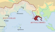 |
72 KB | Affalinnei label | 2 |
| 16:57, 2 June 2009 | Adāta dialects.png (file) | 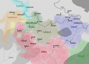 |
245 KB | Dialect areas of Adāta, c. 800 YP. {{commentbox|©2007-2009 by Cedh.}} | 2 |
| 05:21, 25 May 2009 | Akana-blank-NE hemisphere.jpg (file) | 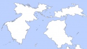 |
98 KB | An overview map of the north-eastern hemisphere of Akana, showing the continents of Peilaš (left), Tuysáfa (right, top), and Zeluzhia (right, bottom). {{commentbox|©2008-2009 by Cedh.}} | 1 |
| 05:01, 25 May 2009 | Akana-blank.jpg (file) |  |
364 KB | A blank map of the planet Akana. {{commentbox|©2008-2009 by Cedh.}} | 1 |
| 14:30, 13 April 2009 | Kechaena-blank.png (file) | 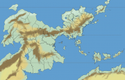 |
97 KB | The original map of Peilaš without labels. : ''See also: Image:Ranradius.png'' {{commentbox|Drawn by Zompist, based on prior proposals by Radius. ©2005.}} | 1 |
| 10:59, 4 March 2009 | Writing.png (file) |  |
30 KB | 1 | |
| 02:53, 23 January 2009 | Wlang06.png (file) |  |
46 KB | 2 | |
| 02:52, 23 January 2009 | Wlang05.png (file) |  |
46 KB | 2 | |
| 02:49, 23 January 2009 | Wlang04.png (file) |  |
45 KB | 2 | |
| 02:48, 23 January 2009 | Wlang03.png (file) |  |
45 KB | 2 | |
| 02:47, 23 January 2009 | Wlang02.png (file) |  |
38 KB | 2 | |
| 07:30, 22 January 2009 | Wlang01.png (file) |  |
37 KB | A map showing the supposed homeland of the Western language family, approx. -3500 YP. ''Map by Cedh.'' | 1 |
| 06:22, 17 November 2008 | Dustbin.png (file) |  |
10 KB | 1 | |
| 06:21, 17 November 2008 | Stophand.png (file) |  |
3 KB | 1 | |
| 06:21, 17 November 2008 | Disambig.png (file) |  |
846 bytes | 1 | |
| 12:33, 20 October 2008 | Languages -4000.png (file) | 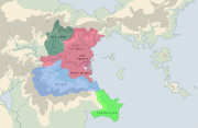 |
82 KB | Language families c. -4000 YP. OUT OF DATE {{commentbox|©2007 by Cedh.}}) | 1 |
| 12:17, 20 October 2008 | Ranradius.png (file) | 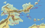 |
101 KB | The first-ever map of Peilaš and surrounding areas, labelled with |original Relay participants. {{commentbox|Drawn by Radius; modifications by Zompist. ©2005.}} | 1 |
| 12:13, 20 October 2008 | Athalē and Huyfárah.png (file) |  |
88 KB | The two great Edastean empires of classical times, Athalē and Huyfárah, c. 400 YP. {{commentbox|©2007 by Cedh.}} | 1 |
| 12:11, 20 October 2008 | Languages -2000.png (file) | 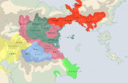 |
91 KB | Language families c. -2000 YP. {{commentbox|©2007 by Cedh.}} | 1 |
| 12:09, 20 October 2008 | Peilaš regions.png (file) | 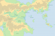 |
86 KB | Map of Peilaš with regional names. {{commentbox|©2007 by Cedh.}} | 1 |
| 12:06, 20 October 2008 | Kasca physical.png (file) | 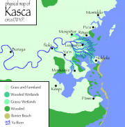 |
36 KB | Physical map of Kasca, c. 170 YP. {{commentbox|©2008 by Radius.}} | 1 |
| 12:01, 20 October 2008 | Huyfarah.gif (file) | 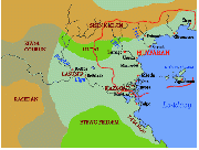 |
27 KB | Map of Huyfárah and the Aiwa valley c. 130 YP. {{ Base map by Radius; borders and names by Zompist.}} | 1 |
| 11:57, 20 October 2008 | Ndak Empire.png (file) |  |
80 KB | Map of the Ndak Empire at the time of Tsinakan (c. -1900 YP). {{commentbox|Map ©2005 by Radius. Text redrawn by Zompist.}} | 1 |
| 11:52, 20 October 2008 | Athalē provinces.png (file) | 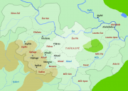 |
40 KB | Provinces of the Empire of Athalē c. 330 YP. Base map by Radius, provinces and labels by Cedh. | 1 |