File list
Jump to navigation
Jump to search
This special page shows all uploaded files.
| Date | Name | Thumbnail | Size | User | Description | Versions |
|---|---|---|---|---|---|---|
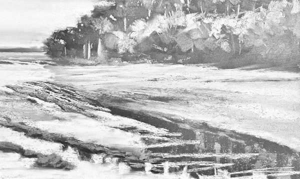
| 09:55, 29 December 2024 | Mudflats1.jpg (file) |  |
98 KB | Moose-tache | 1 | |
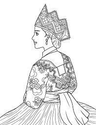
| 13:18, 21 December 2024 | Hazōkendress.jpg (file) |  |
10 KB | Moose-tache | 1 | |
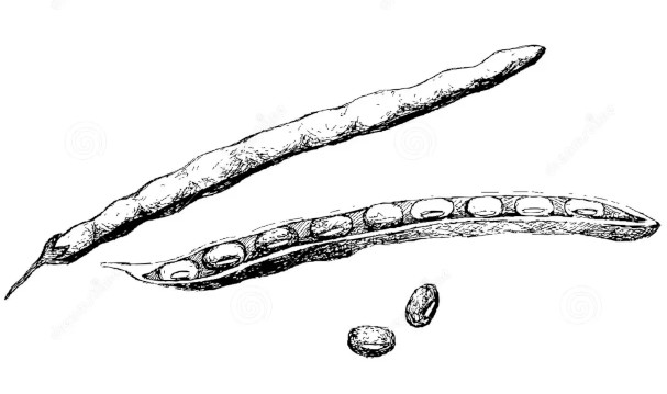
| 04:16, 13 December 2024 | Hazōkenbean.jpg (file) |  |
30 KB | Moose-tache | 1 | |
| 04:14, 13 December 2024 | Hazōkenboat.jpg (file) |  |
88 KB | Moose-tache | 1 | |
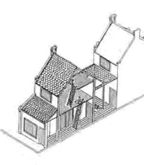
| 04:13, 13 December 2024 | Hazōkenhouse.png (file) |  |
42 KB | Moose-tache | 1 | |
| 19:32, 1 December 2024 | NewPoton.jpg (file) |  |
54 KB | Moose-tache | 1 | |
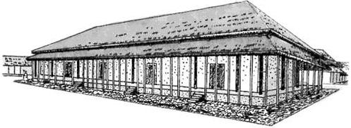
| 19:14, 1 December 2024 | Tendoarchitecture.jpg (file) |  |
21 KB | Moose-tache | 1 | |
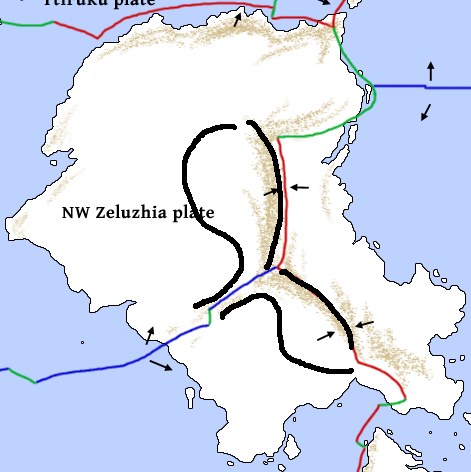
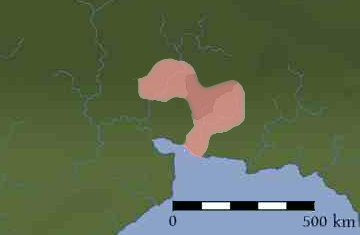
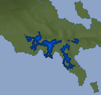
| 17:43, 9 November 2021 | SahaxeRange.png (file) |  |
26 KB | Mouse-tache | A map of the range in which Sahaśe is spoken. | 1 |
| 06:55, 23 October 2021 | Habici vocabulary.pdf (file) | 1.95 MB | Zju | 1 | ||
| 17:53, 4 February 2021 | Zeluzhia climates orthographic.png (file) |  |
153 KB | Corumayas | Draft of a revised climate map for Zeluzhia | 1 |
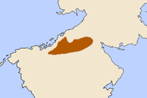
| 17:27, 12 January 2021 | Zeluzhian plateau.png (file) |  |
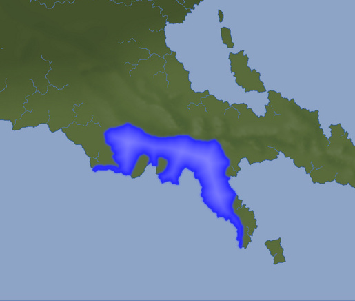
83 KB | Corumayas | approximate location of Zeluzhian plateau? | 1 |
| 09:14, 18 May 2020 | Dzoqi.pdf (file) | 332 KB | Akam Chinjir | 6 | ||
| 10:29, 17 May 2020 | Tome niloyi.png (file) |  |
53 KB | Dhok | 1 | |
| 06:22, 17 May 2020 | Puvangengo.pdf (file) | 192 KB | Frislander | 10 | ||
| 04:19, 15 May 2020 | SouthPeilas.png (file) |  |
125 KB | Moose-tache | 1 | |
| 00:39, 3 September 2018 | Antarctica-VerticalPerspective.png (file) |  |
360 KB | Cedh | 1 | |
| 00:39, 3 September 2018 | Antarctica-Orthographic.png (file) |  |
476 KB | Cedh | 1 | |
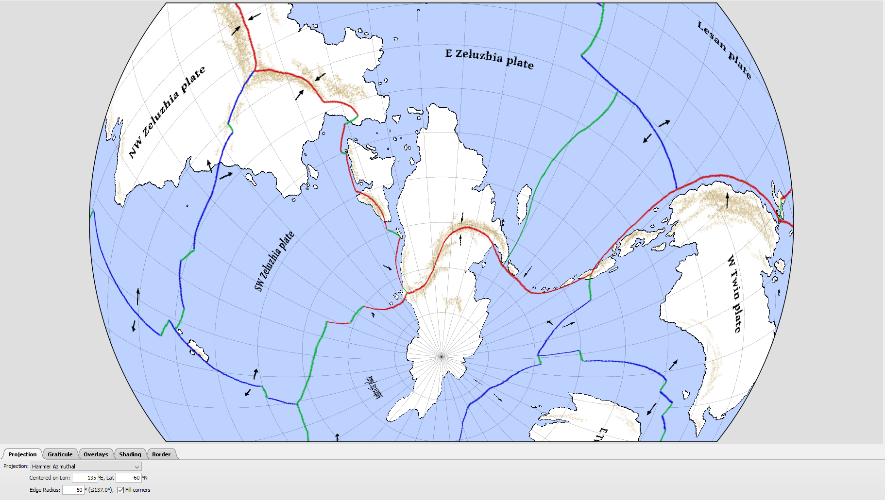
| 00:39, 3 September 2018 | Antarctica-HammerAzimuthal.png (file) |  |
539 KB | Cedh | 1 | |
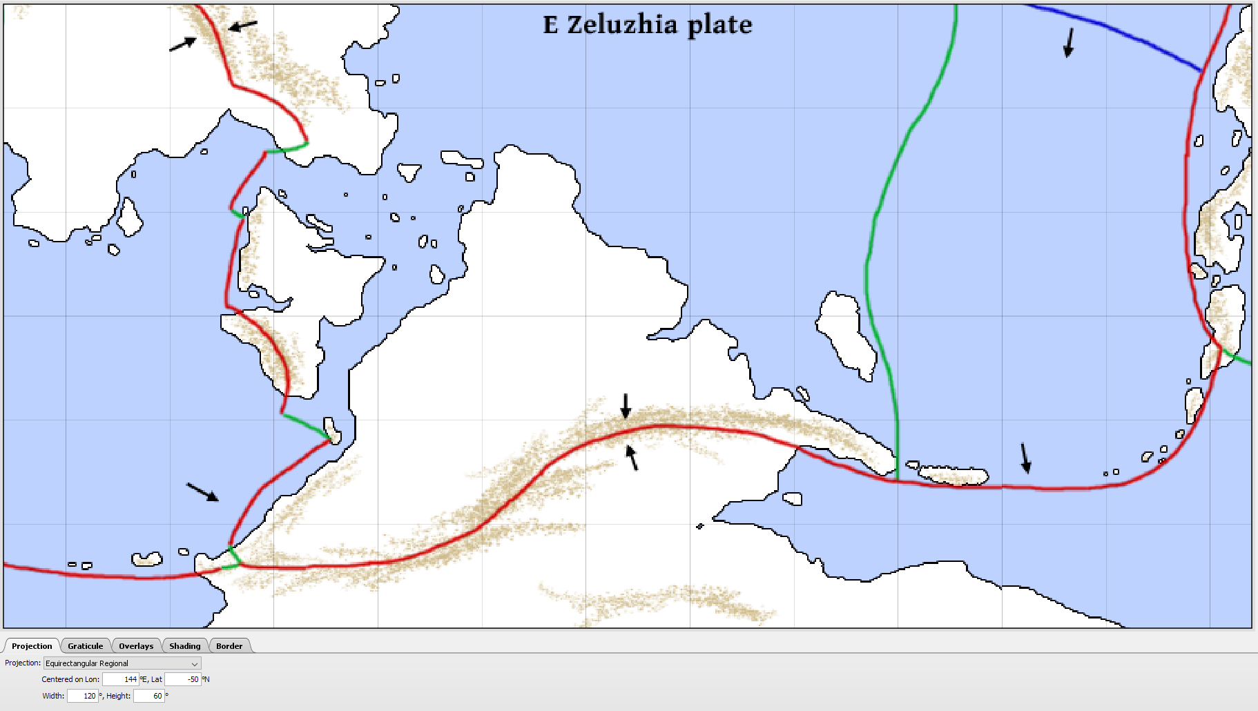
| 00:38, 3 September 2018 | Antarctica-EquirectangularRegional.png (file) |  |
166 KB | Cedh | 1 | |
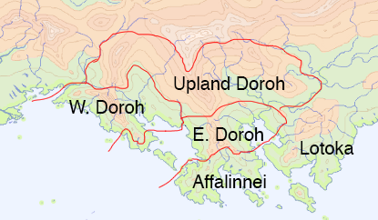
| 14:40, 4 July 2017 | Doroh-suggestion5.png (file) |  |
104 KB | Corumayas | 1 | |
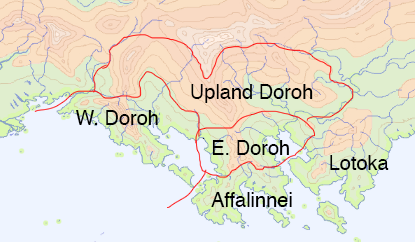
| 00:48, 4 July 2017 | Doroh-suggestion4.png (file) |  |
108 KB | Corumayas | 1 | |
| 22:44, 3 July 2017 | Doroh-suggestion3.png (file) |  |
107 KB | Corumayas | 1 | |
| 17:50, 3 July 2017 | Doroh-suggestion2.png (file) |  |
102 KB | Corumayas | 1 | |
| 17:49, 3 July 2017 | Doroh-suggestion1.png (file) |  |
99 KB | Corumayas | 1 | |
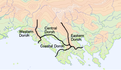
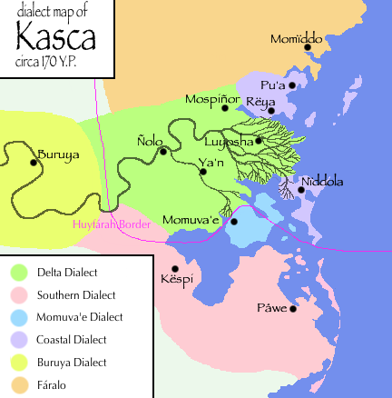
| 22:41, 2 July 2017 | Doroh-dialects-v2.png (file) |  |
120 KB | Dunomapuka | 1 | |
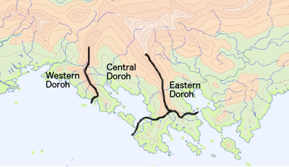
| 11:09, 29 June 2017 | Doroh-dialects-v1.png (file) |  |
120 KB | Dunomapuka | 1 | |
| 06:53, 22 January 2017 | Lu-giəma.png (file) | 14 KB | Cedh | The native name of the Fáralo alphabet, ''lu-giəma æm Fáralo'', written in the script itself. | 1 | |
| 06:07, 22 January 2017 | Fáralo alphabet.jpg (file) |  |
183 KB | Cedh | b/w & better contrast | 2 |
| 12:03, 30 November 2016 | Naidda dialects.png (file) |  |
34 KB | Cedh | 2 | |
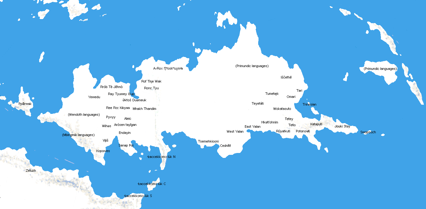
| 11:28, 30 November 2016 | SE Tuysafa languages 0YP.png (file) |  |
122 KB | Cedh | A linguistic map of southeastern Tuysáfa around 0 YP, showing the distribution of Dumic languages (in red) and T1 languages (in green). Base map by Thedukeofnuke, data by Cedh. ©2012-2015. Category:Maps Category:Language families | 1 |
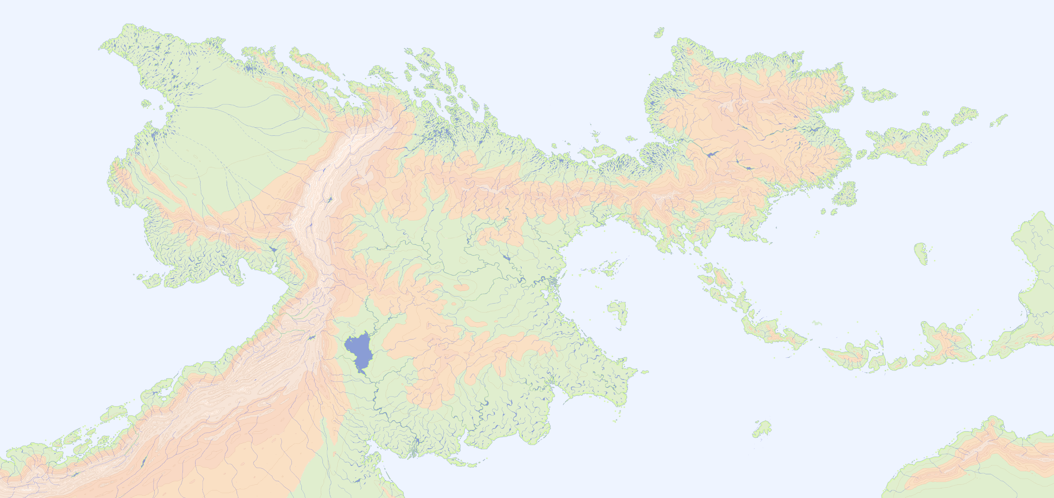
| 11:24, 30 November 2016 | Peilash physical map general unlabeled.png (file) |  |
2.54 MB | Cedh | A blank physical map of Northern Peilaš. {{commentbox|©2010 by a pocketful of songs.}} Category:Maps Category:Geography | 1 |
| 11:00, 29 November 2016 | Peilaš linguistic 0YP.jpg (file) |  |
293 KB | Cedh | A linguistic map of Peilaš around 0 YP, showing the approximate distribution of the major language families. Base map by pocketful of songs, language data by CatDoom. From west to east: * Gray-blue: Lukpanic languages * Purple: [[Western language... | 1 |
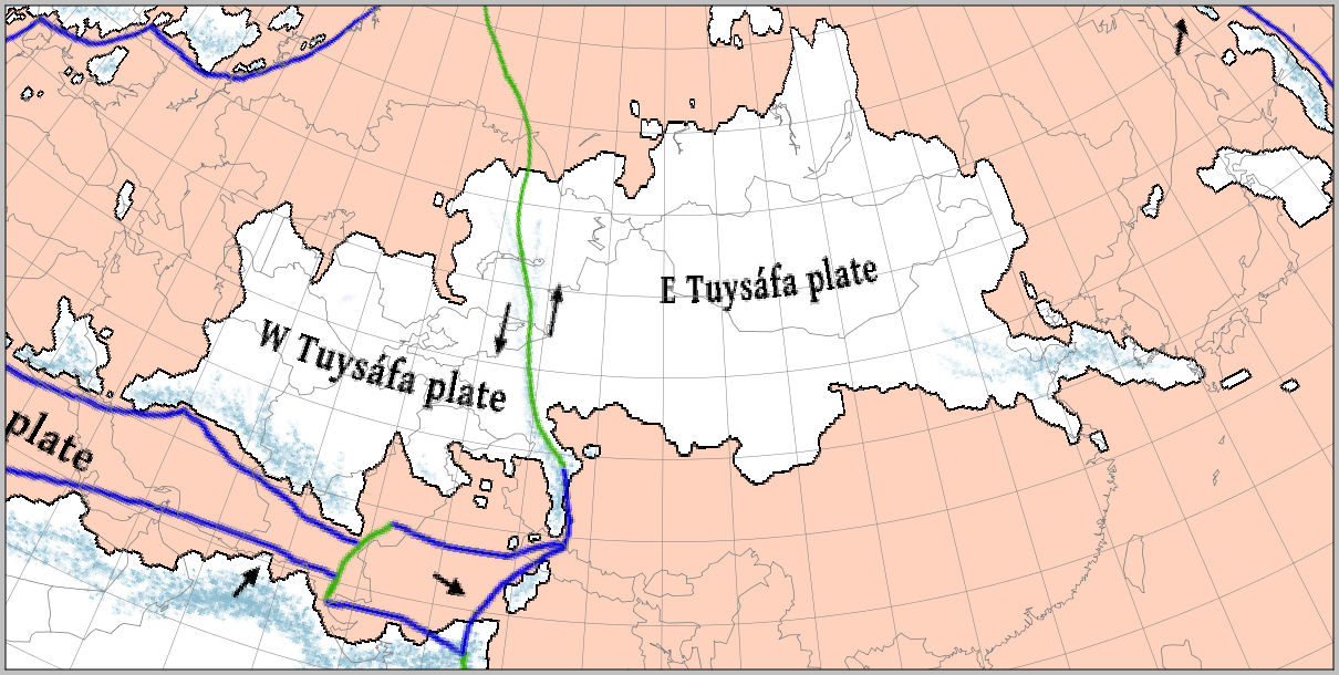
| 16:05, 24 August 2015 | Tuysafa n america.png (file) |  |
240 KB | Corumayas | A base map of Tuysáfa overlaid with the outline of North America. The scale and latitude of the overlay are the same as the base map. (Base map by Cedh; projection and overlay by Corumayas) | 1 |
| 16:05, 24 August 2015 | Tuysafa europe.png (file) |  |
280 KB | Corumayas | A base map of Tuysáfa overlaid with the outline of Europe and North Africa. The scale and latitude of the overlay are the same as the base map. (Base map by Cedh; projection and overlay by Corumayas) | 1 |
| 16:04, 24 August 2015 | Tuysafa asia.png (file) |  |
264 KB | Corumayas | A base map of Tuysáfa overlaid with the outline of Asia. The scale and latitude of the overlay are the same as the base map. (Base map by Cedh; projection and overlay by Corumayas) | 1 |
| 16:02, 24 August 2015 | Peilash n america.png (file) |  |
253 KB | Corumayas | A blank base map of Peilaš overlaid with the outline of North America. The scale and latitude of the overlay are the same as the base map. (Base map by Cedh; projection and overlay by Corumayas) | 1 |
| 16:01, 24 August 2015 | Peilash europe.png (file) |  |
285 KB | Corumayas | A blank base map of Peilaš overlaid with the outline of Europe and North Africa. The scale and latitude of the overlay are the same as the base map. (Base map by Cedh; projection and overlay by Corumayas) | 1 |
| 15:58, 24 August 2015 | Peilash asia.png (file) |  |
262 KB | Corumayas | A blank base map of Peilaš overlaid with the outline of Asia. The scale and latitude of the overlay are the same as the base map. (Base map by Cedh; projection and overlay by Corumayas) | 1 |
| 01:08, 30 July 2015 | TuysafaY0.PNG (file) |  |
98 KB | Zju | Filled some gaps and fixed some issues as per contributors' notes. | 3 |
| 14:00, 16 February 2015 | Akana pressure and winds july.png (file) |  |
186 KB | Corumayas | A global map of atmospheric pressure and winds in July. Base map by Cedh, data by a pocketful of songs. Originally posted to the ZBB on 18 May 2010. | 1 |
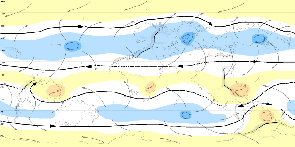
| 13:58, 16 February 2015 | Akana pressure and winds january.png (file) |  |
215 KB | Corumayas | A global map of atmospheric pressure and winds in January. Base map by Cedh, data by A pocketful of songs. Originally posted to the ZBB on 18 May 2010. | 1 |
| 13:55, 16 February 2015 | Akana ocean currents.png (file) |  |
821 KB | Corumayas | A global map of ocean currents. Base map by Cedh, data by A pocketful of songs. Originally posted to the ZBB on 18 May 2010. | 1 |
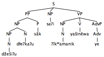
| 06:50, 17 September 2014 | Syllable-structure-Aktosh-Tuemeuk.png (file) |  |
2 KB | Vec | The syllable structure of Əktoś Tuəmeuk. | 1 |
| 07:52, 27 May 2014 | Ll area.png (file) |  |
12 KB | Zju | 1 | |
| 14:17, 26 May 2014 | CR14.png (file) |  |
70 KB | Pole, the | 4 | |
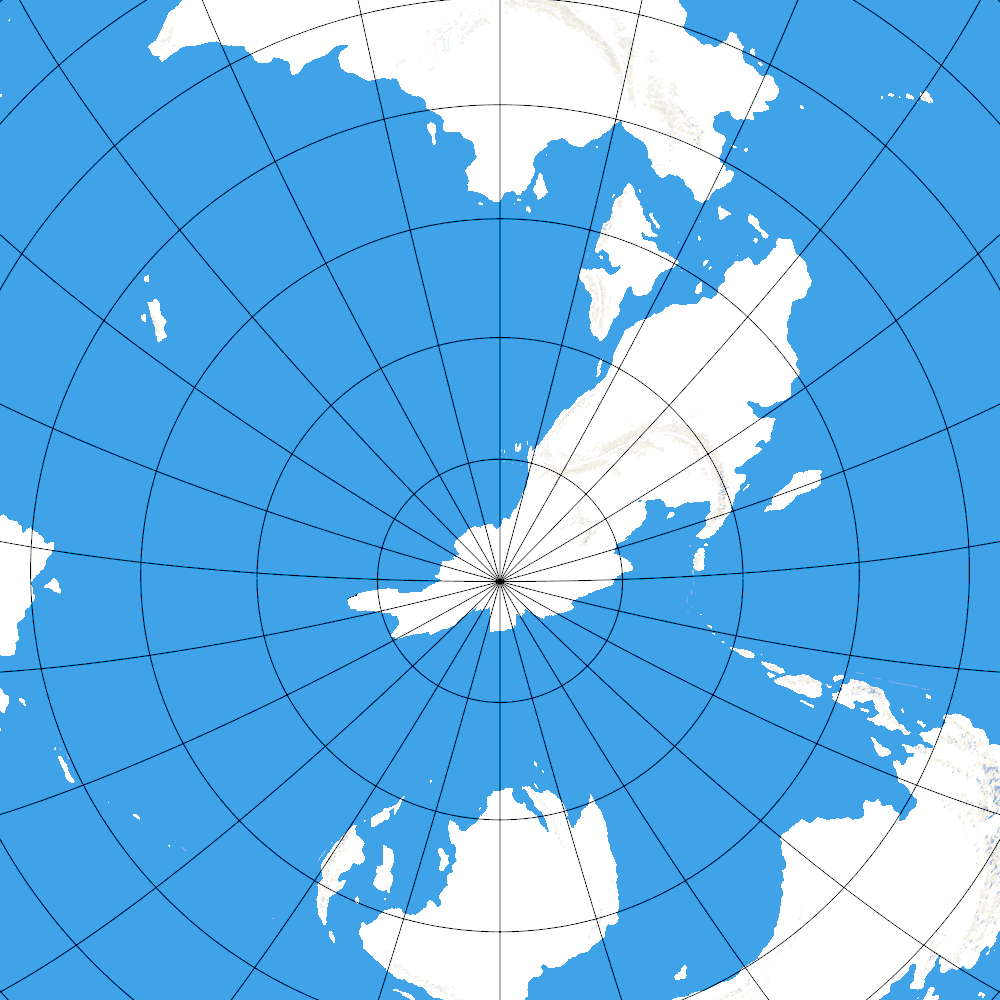
| 10:57, 25 May 2014 | Antarctica.png (file) |  |
268 KB | Pole, the | 3 | |
| 10:48, 25 May 2014 | Tuysafa.png (file) |  |
341 KB | Pole, the | 3 | |
| 14:19, 20 November 2013 | Tumetıęk lexicon.pdf (file) | 1.59 MB | Clıck | A short lexicon of Tumetıęk. 400-odd words. | 1 | |
| 14:06, 20 November 2013 | Tumetıęk.pdf (file) | 3.89 MB | Clıck | A reference grammar of Tumetıęk. | 1 | |
| 06:49, 21 August 2013 | Language graph.png (file) | 209 KB | Pole, the | Raster version of File:Graph.pdf. cc-by-sa 2013 by the Devilcat | 1 | |
| 06:48, 21 August 2013 | Graph.pdf (file) | 38 KB | Pole, the | 3 | ||
| 09:19, 16 June 2013 | Yal4.png (file) |  |
33 KB | Pole, the | Early North Yalan speaking area. | 1 |
| 09:17, 16 June 2013 | Yal3.png (file) |  |
37 KB | Pole, the | West Yalan speaking area. | 1 |
| 09:14, 16 June 2013 | Yal2.png (file) |  |
36 KB | Pole, the | 2 | |
| 08:58, 16 June 2013 | Yal1.png (file) |  |
38 KB | Pole, the | Yalan speaking area. | 1 |
| 15:17, 7 May 2013 | Yuska.png (file) |  |
114 KB | Cedh | (transparent background) | 2 |
| 09:23, 13 May 2012 | Test.JPG (file) |  |
7 KB | Tzirtzi | this is a test that uploading is still working | 1 |
| 10:56, 4 March 2012 | Sc city-3 .png (file) |  |
248 KB | Thedukeofnuke | 1 | |
| 10:56, 4 March 2012 | Sc ruins-2 .png (file) |  |
352 KB | Thedukeofnuke | 1 | |
| 09:25, 4 March 2012 | Sc river-7 .png (file) |  |
183 KB | Thedukeofnuke | 1 | |
| 08:52, 4 March 2012 | Sc island-1 .png (file) |  |
161 KB | Thedukeofnuke | Correct resolution. | 2 |
| 20:47, 19 December 2011 | Australic.jpg (file) |  |
44 KB | Brandrinn | 1 | |
| 16:01, 11 May 2011 | Ndak-empire--1800.png (file) |  |
506 KB | Cedh | 2 | |
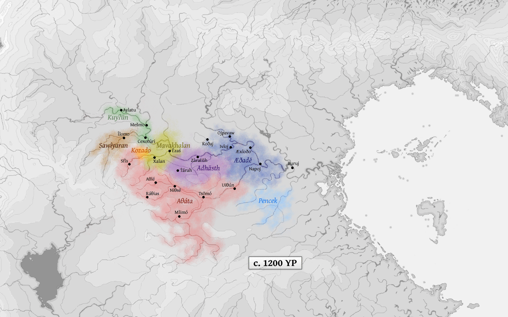
| 15:37, 9 May 2011 | Languages-1st-generation-daiadak-1200.png (file) |  |
393 KB | Cedh | A linguistic map showing the first generation of Dāiadak languages around 1200 YP (i.e. those languages directly descended from Adāta). {{commentbox|©2010 by Cedh.}} | 1 |
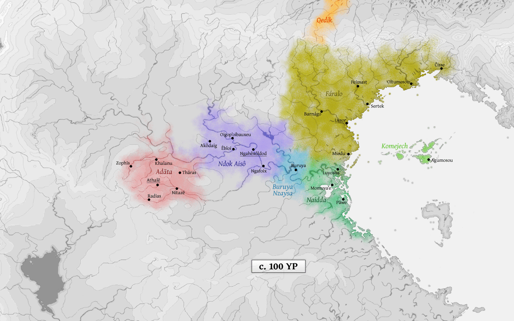
| 15:35, 9 May 2011 | Languages-1st-generation-edastean-100.png (file) |  |
436 KB | Cedh | A linguistic map showing the first generation of Edastean languages around 100 YP (i.e. those languages directly descended from Ndak Ta). {{commentbox|©2010 by Cedh.}} | 1 |
| 15:32, 9 May 2011 | Athale-and-huyfarah-400.png (file) |  |
484 KB | Cedh | A map of the Empire of Athalē and Huyfárah around 400 YP, when both empires had more or less reached their maximum extension, with some linguistic info about the major Edastean languages of the time. {{commentbox|©2010 by Cedh.}} | 1 |
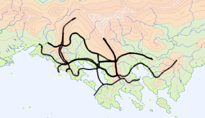
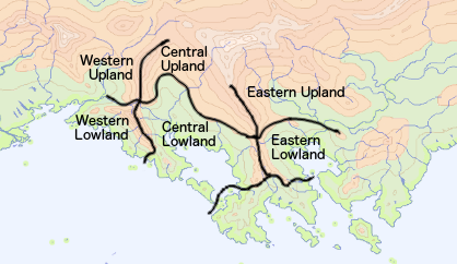
| 14:24, 9 May 2011 | NE-Peilash-physical3.png (file) |  |
1.13 MB | Cedh | A coloured version of this map. Map by pocketful of songs, modifications by Cedh. | 1 |
| 12:15, 3 May 2011 | PW Ex27.png (file) |  |
14 KB | Cedh | 1 | |
| 12:15, 3 May 2011 | PW Ex26.png (file) |  |
14 KB | Cedh | 1 | |
| 12:14, 3 May 2011 | PW Ex25.png (file) |  |
9 KB | Cedh | 1 | |
| 12:13, 3 May 2011 | PW Ex24.png (file) |  |
9 KB | Cedh | 1 | |
| 12:13, 3 May 2011 | PW Ex23.png (file) |  |
7 KB | Cedh | 1 | |
| 12:13, 3 May 2011 | PW Ex22.png (file) |  |
9 KB | Cedh | 1 | |
| 12:13, 3 May 2011 | PW Ex21.png (file) |  |
7 KB | Cedh | 1 | |
| 12:12, 3 May 2011 | PW Ex20.png (file) |  |
8 KB | Cedh | 1 | |
| 12:12, 3 May 2011 | PW Ex19.png (file) |  |
9 KB | Cedh | 1 | |
| 12:12, 3 May 2011 | PW Ex18.png (file) |  |
9 KB | Cedh | 1 | |
| 12:12, 3 May 2011 | PW Ex17.png (file) |  |
10 KB | Cedh | 1 | |
| 12:11, 3 May 2011 | PW Ex16.png (file) |  |
9 KB | Cedh | 1 | |
| 12:11, 3 May 2011 | PW Ex15.png (file) |  |
7 KB | Cedh | 1 | |
| 12:11, 3 May 2011 | PW Ex14.png (file) |  |
8 KB | Cedh | 1 | |
| 12:11, 3 May 2011 | PW Ex13.png (file) |  |
10 KB | Cedh | 1 | |
| 12:10, 3 May 2011 | PW Ex12.png (file) |  |
13 KB | Cedh | 1 | |
| 12:10, 3 May 2011 | PW Ex11.png (file) |  |
11 KB | Cedh | 1 | |
| 12:09, 3 May 2011 | PW Ex10.png (file) |  |
10 KB | Cedh | 1 | |
| 12:09, 3 May 2011 | PW Ex9.png (file) |  |
11 KB | Cedh | 1 | |
| 12:08, 3 May 2011 | PW Ex8.png (file) |  |
10 KB | Cedh | 1 | |
| 12:08, 3 May 2011 | PW Ex7.png (file) |  |
9 KB | Cedh | 1 | |
| 12:08, 3 May 2011 | PW Ex6.png (file) |  |
6 KB | Cedh | 1 | |
| 12:08, 3 May 2011 | PW Ex5.png (file) |  |
8 KB | Cedh | 1 | |
| 12:07, 3 May 2011 | PW Ex4.png (file) |  |
9 KB | Cedh | 1 | |
| 12:07, 3 May 2011 | PW Ex3.png (file) |  |
7 KB | Cedh | 1 | |
| 12:07, 3 May 2011 | PW Ex2.png (file) |  |
7 KB | Cedh | 1 | |
| 12:06, 3 May 2011 | PW Ex1.png (file) |  |
8 KB | Cedh | 1 | |
| 05:25, 1 January 2011 | Sc arid-5 .png (file) |  |
112 KB | Cedh | 1 | |
| 05:25, 1 January 2011 | Sc river-6 .png (file) |  |
88 KB | Cedh | 1 | |
| 05:24, 1 January 2011 | Sc river-5 .png (file) |  |
131 KB | Cedh | 1 | |
| 06:00, 16 October 2010 | NE-Peilash-physical2.png (file) |  |
701 KB | Cedh | A slightly modified version of this map (smaller area, blue ocean, coastline, png format). Map by pocketful of songs, modifications by Cedh. | 1 |
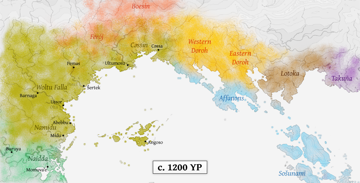
| 13:04, 7 August 2010 | Isthmus history 10 +1200.png (file) |  |
736 KB | Cedh | A historical map of the Isthmus region, c. 1200 YP. {{commentbox|©2010 by Cedh. <br>This map is part of the series History of the Isthmus region.}} Category:Maps | 1 |
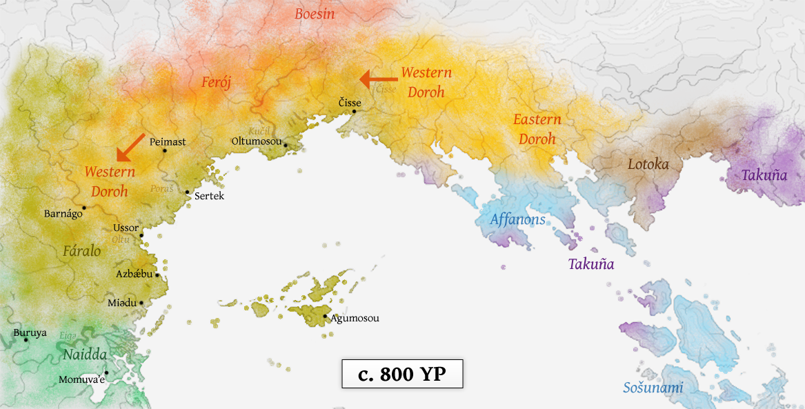
| 13:02, 7 August 2010 | Isthmus history 09 +800.png (file) |  |
745 KB | Cedh | A historical map of the Isthmus region, c. 800 YP. {{commentbox|©2010 by Cedh. <br>This map is part of the series History of the Isthmus region.}} Category:Maps | 1 |